
This 10-part series is a quick history of the name origins of our counties in alphabetical order.
Alamance County was formed in 1849. It was created out of land previously belonging to Orange County. The county is named for both the 1771 Battle of Alamance and Alamance Creek. The word “alamance” is an Indigenous word, meaning “blue clay” or “noisy river.” The Occaneechi Band of the Saponi Nation—one of the eight state-recognized tribes—and the Sissipahaw are associated with the land.
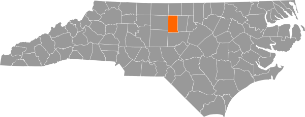
Alexander County was created in 1847 out of portions of Iredell, Wilkes, and Caldwell Counties. It is named in honor of William Julius Alexander (1797–1857), speaker of the North Carolina House of Commons. Alexander was born in Salisbury and graduated from the University of North Carolina in 1816. Alexander County’s largest community is Bethlehem, population 3,928.
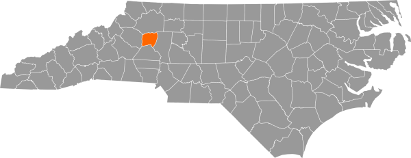
Alleghany County was created in 1859 from parts of Ashe County. The name is derived from either the Allegewi Indian tribe or the Delaware Indian word “oolikhanna,” meaning “beautiful stream.” The Cherokee and Shawnee tribes initially inhabited the county. Construction of the Blue Ridge Parkway through Alleghany County has allowed for a robust tourism industry. The Blue Ridge Mountain Heritage Festival is held annually in Sparta.
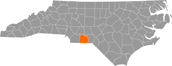
Anson County was created in 1750 from a section of Bladen County. It is named after George Anson, First Baron Anson (1697–1762), a British admiral. Anson County was originally home to the Catawba and Waxhaw tribes. Pee Dee National Wildlife Refuge is in Anson County; it’s popular with birdwatchers, hikers, and boaters.

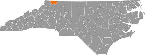
Ashe County was formed in 1799. It was named for Governor Samuel Ashe (1725–1813). Ashe fought in the Revolutionary War as a captain in the First Troop of North Carolina Continental Dragoon Regiment. He was later part of the North Carolina Senate and superior court before winning the governorship in 1795. Ashe County is the largest producer of Christmas trees in the state.
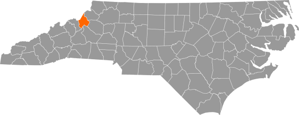
Avery County was formed in 1911, one of the last counties to be created in North Carolina. It is named after Colonel Waightstill Avery, who served in the Revolutionary War. He became the first Attorney General of North Carolina after the Declaration of Independence was signed. The entrance to Grandfather Mountain State Park is in Banner Elk.
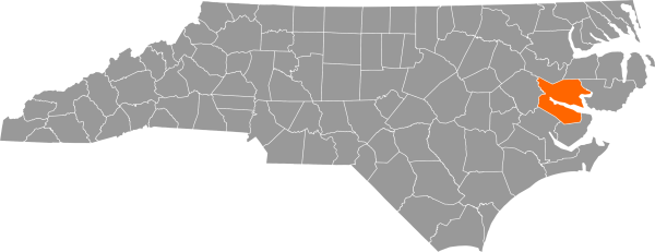
Beaufort County was formed from the former Bath County in 1705. It was first known as Pamptecough Precinct, then received its formal name in 1712. The county is named for Henry Somerset, First Duke of Beaufort. Beaufort was also a Lord Proprietor, a person granted a royal charter by the king to establish an English colony. The county name is pronounced the correct way in North Carolina: “bow-fert.”
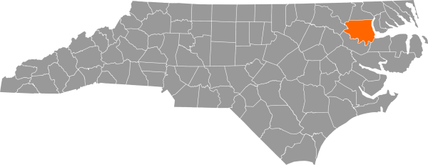
Bertie County was established in 1722 with land taken from Albemarle County. It is named for James and Henry Bertie, two of North Carolina’s Lords Proprietors. Bertie County is notable for its agricultural production, with fertile soils ideal for a variety of crops.
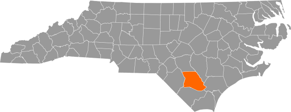
Bladen County, the third largest in the state, was created in 1734. Known as a “mother county,” Bladen County originally contained 55 of the state’s 100 counties. It is named for Martin Bladen, Lord Commissioner of Trade and Plantation in North Carolina. Bladen County is home to the Waccamaw Siouan tribe, one of eight state-recognized American Indian tribes in North Carolina.
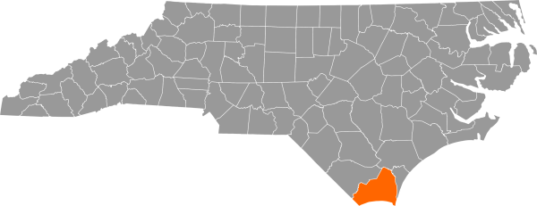
Brunswick County was established in 1764 and created out of New Hanover County and Bladen County land. It is named to honor King George I, Duke of Brunswick and Lüneburg. Brunswick County is home to the Old Baldy lighthouse and the NC Maritime Museum at Southport.
Come back for part two and find out which counties are named for the first president of UNC, a delegate to the Continental Congress, and a Revolutionary War colonel!
Sources: