
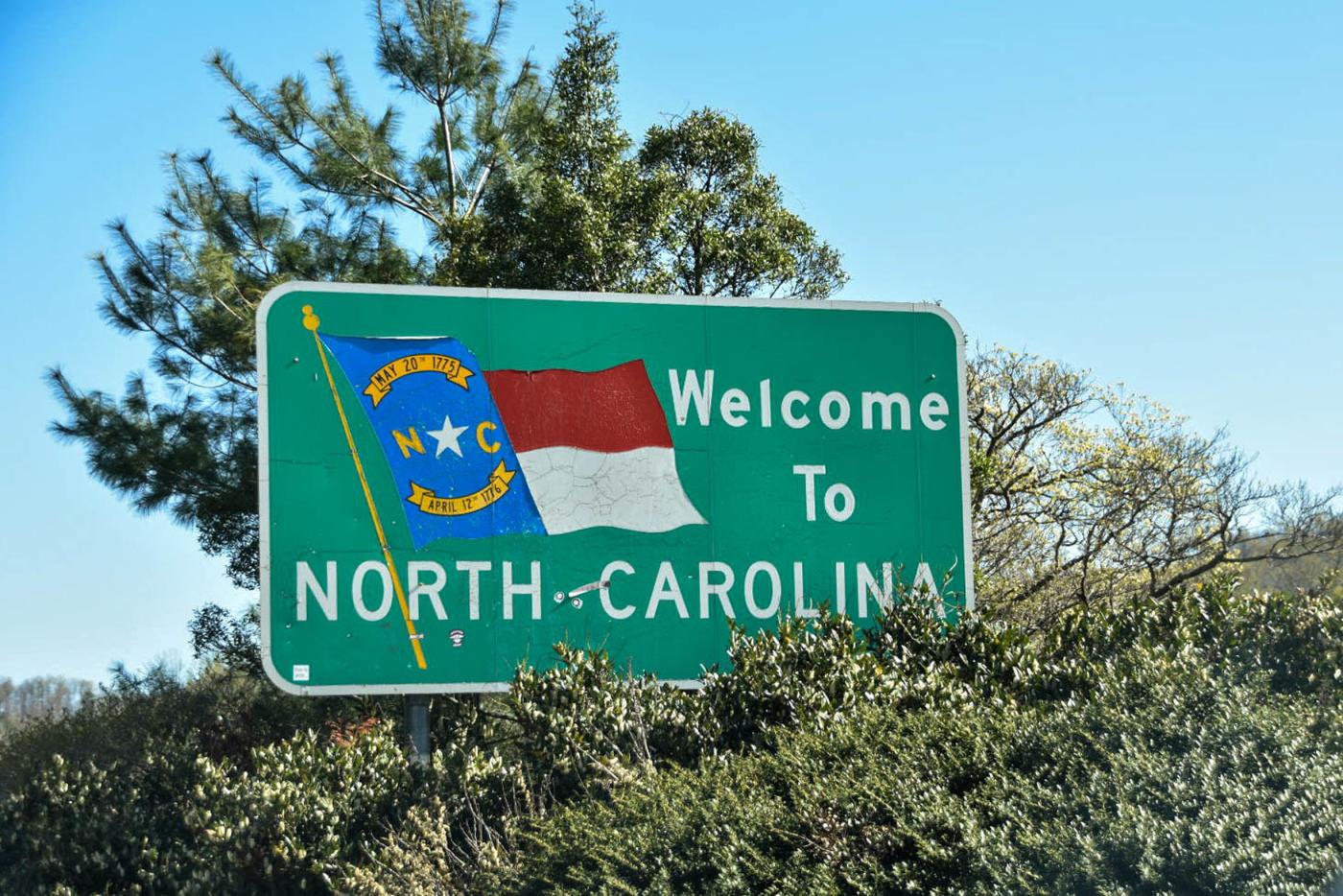
The first counties in North Carolina were established in the 1600s when colonists arrived on our shores. As the European population grew, the need for localized governments led to the creation of more counties. The last two counties were established in 1911, making the count an even 100. The names of our counties are as varied and unique as the people of North Carolina.
This 10-part series is a quick history behind the name origins of our counties in alphabetical order. All the previous entries can all be found on the North Carolina Museum of History blog page.
Guilford County was created in 1771 out of Orange and Rowan Counties. It was named for Francis North (1704–1790), the First Earl of Guilford. The Revolutionary War Battle of Guilford Courthouse took place near Greensboro in March of 1781. The British Army, led by General Charles Cornwallis, won the battle. In the aftermath, heavy casualties forced the British to abandon the Carolinas for Virginia, where they surrendered at Yorktown months later in October. The city of Greensboro holds a reenactment of the battle every March to commemorate the event.
Halifax County was created in 1758 from Edgecombe County. It was named for George Montagu Dunk, Second Earl of Halifax (1716–1771). On April 12, 1776, the state’s Fourth Provincial Congress unanimously passed the Halifax Resolves. The document made North Carolina the first colony to authorize its Continental Congress delegates to vote for independence. The date may look familiar to North Carolinians. It is written on North Carolina’s state flag, and is the reason we have the slogan, “First in Freedom.”
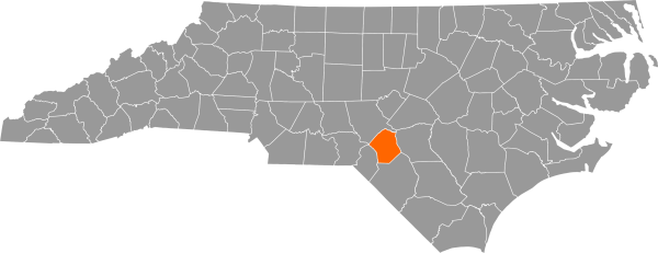
Harnett County was created in 1855 and was formed from part of Cumberland County. It is named for Cornelius Harnett (1723–1781), a prominent Revolutionary War figure, delegate to the Continental Congress, and the first person to publicly read the Declaration of Independence in North Carolina. The Civil War Battle of Averasboro took place in Harnett County in March 1865. The fight delayed the Union advance, enabling the Confederate army to concentrate their forces. They attacked in the last Civil War battle in North Carolina in Bentonville three days later.
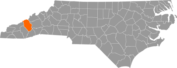
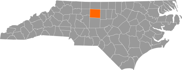
Haywood County was formed from Buncombe County in 1808. It was named for North Carolina State Treasurer John Haywood (1755–1827). Haywood County is nestled in the Blue Ridge Mountains. Many festivals are held every year to celebrate the area’s history and Appalachian culture, like the Apple Harvest Festival in Waynesville and the Smoky Mountain Folk Festival in Lake Junaluska.
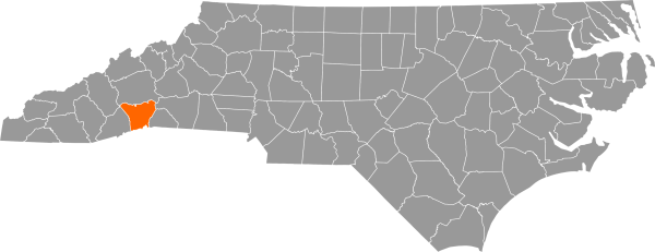
Henderson County was formed in 1838 out of Buncombe County. The county is named for Chief Justice of the State Supreme Court Leonard Henderson (1772–1833), who died five years before it was created. Pulitzer Prize-winning author, poet, and journalist Carl Sandburg made his home in Flat Rock in Henderson County. His house is a National Historic Site that can be visited year-round.
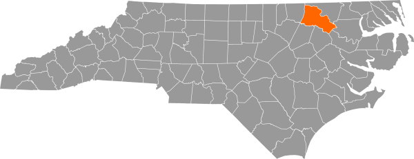
Hertford County was formed in 1759 out of Bertie, Northampton, and Chowan Counties. It was named to honor Francis Seymour-Conway (1718–1794), Marquess of Hertford. The Chowan River forms the eastern border of Hertford County. The river’s wide, slow-moving water makes it useful for both industry and recreation. The Union army also used the river as a strategic naval corridor during the Civil War. In February of 1862, the Union gunboats approached up the river when they attacked and burned down Winton, the county seat, making it the first town in North Carolina to be burned by Union forces.
Hoke County was formed from parts of Cumberland and Robeson Counties in 1911, making it one of the two youngest counties. It is named for Confederate Major General Robert F. Hoke (1837–1912), who later lived in Raleigh and served as Director of the North Carolina Railroad. Army base Fort Bragg takes up one third of the northern part of the county. Every year, Hoke County celebrates North Carolina’s status as one of the largest turkey producers by holding the North Carolina Turkey Festival.
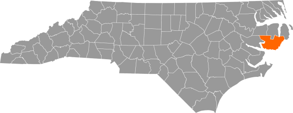
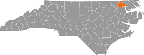
Hyde County was originally formed in 1705 as Wickham Precinct of Bath County. It was renamed Hyde Precinct in 1712, then became Hyde County when Bath County was abolished in 1739. The county’s name honors Edward Hyde (1667–1712), governor of North Carolina from 1711 until 1712. The oldest operating lighthouse in North Carolina is Ocracoke Lighthouse, completed in 1823. It is situated on Ocracoke Island in the Outer Banks, which is only accessible by boat or small plane.
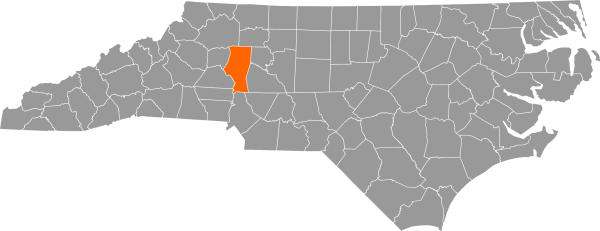
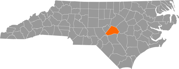
Iredell County was created in 1788, out of part of Rowan County. It was named for James Iredell (1751–1799), a Revolutionary War figure and one of the first associate justices to serve on the Supreme Court. Iredell County is home to the North Carolina Auto Racing Hall of Fame. Dozens of hot air balloons also fill the sky every fall when the Carolina BalloonFest takes place in October.
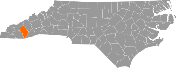
Jackson County was created in 1851 from Haywood and Macon Counties and was named for President Andrew Jackson (1767–1845). The county boasts 185 named summits, 250 named creeks and rivers, and the highest point along the Blue Ridge Parkway. The county also contains a significant amount of US National Forest land, featuring the Tuckasegee Gorge located within Roy Taylor Forest. The Qualla Boundary, home of the Eastern Band of Cherokee Indians, is situated in Jackson and Swain Counties, with some smaller areas in nearby counties.
In the next part of Naming North Carolina, we’ll discuss two counties named for Royal Governors, a county named for a queen, and a county named for a founding father and president.
Sources: