
Henry Eustace McCulloh Land Survey Book
This transcript includes historical language, attitudes, and descriptions that may be harmful or difficult to view. These materials are presented as part of the historical record and reflect the time in which they were created.
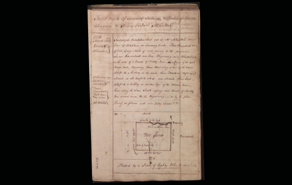
[Sheet is divided into two text sections (transcribed) and one map not transcribed]
[top section goes across entire sheet]
Field Book of sundry Surveys, & Plans of Lands belonging to Henry Eustace McCulloh.
[Section forming a left column below the top section]
1773.
March 30.th }
Rowan Co. }
No Carolina. }
Wm Giles Comp: Carr[?]:
John Bowen } C.C.
John Silvers }
Present
David Smith }
[Gessh?]: Hunt. }
Hn: Silvers. }
H.C: McCulloh. }
92654
[Section at right below top section]
Surveyed & Subdivided out of Mr McCulloh's manor. Tract of 1243 acres on Swearing Creek. Two hundred acres of land, lying North of, and joining to the plantation whereon David Smith now lives, Beginning at a Black Jack on the side of a branch of Muddy Run, a Corner of the said Manor tract, Running thence West along a line of the same 160 po to a hickory in the same; thence North at 120 po crossing a branch in all 200 po to a B.O.—near a branch; thence East 160 po to a hickory in another line of the Manor tract; thence along the same South crossing said branch of Muddy Run several times, to the Beginning;—as by the plan thereof, as follows, will more fully appear.
[Section below the one transcribed above. This contains a rectangular map showing three streams of water. The following words are used to describe the map.]
No 1. v[maybe ~?] Merrell
South to the beg.g [at top of rectangular map]
Plotted by a Scale of Eighty Poles to an Inch.