
The first counties in North Carolina were established in the 1600s when colonists arrived on our shores. As the European population grew, the need for localized governments led to the creation of more counties. The last two counties were established in 1911, making the count an even 100. The names of our counties are as varied and unique as the people of North Carolina.
This 10-part series is a quick history behind the name origins of our counties in alphabetical order. The first 10 counties were covered in a previous blog.
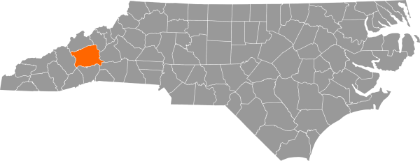
Buncombe County was formed in 1791. It was originally named Union County but eventually changed to Buncombe County to honor Revolutionary War veteran and plantation owner Colonel Edward Buncombe (1742–1778). The land was originally home to the Cherokee people. Early settlers in Buncombe County were Scots-Irish, German, and Dutch. At the time of its creation, the county encompassed most of western North Carolina.
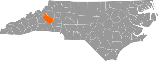
Burke County was formed in 1777 from part of Rowan County. It was named for Thomas Burke (1747–1783), a delegate to the Continental Congress and governor of the state from 1781 to 1782. While governor, Burke was captured and imprisoned in South Carolina. He escaped after four months and resumed his gubernatorial duties. Burke never recovered from his days in prison and died in December 1783.
Burke County is home to the Berry site, which encompasses the historical Joara Native American settlement and the 1567 Spanish Fort San Juan. Artifacts belonging to Mississippian people and the Spanish have been excavated at this important archaeological site near Morganton.
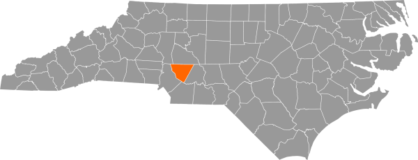
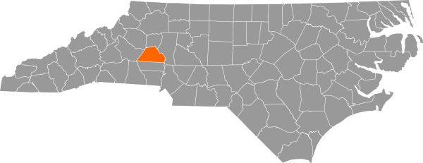
Cabarrus County is named for Stephen Cabarrus (1754–1808), speaker of the North Carolina House of Commons and a trustee of the University of North Carolina. It was formed in 1792 from a portion of neighboring Mecklenburg County. The area was originally the home of the Catawba tribe and was settled by people of Scots-Irish and German descent. Cabarrus County is home to the first documented discovery of gold in the US in 1799 at a site known today as Reed Gold Mine.
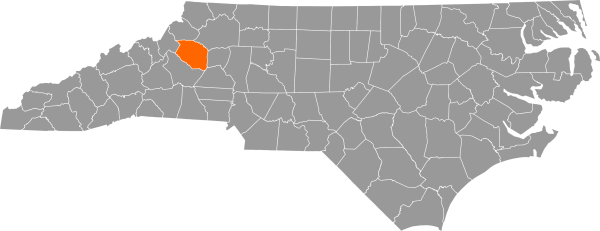
Caldwell County was carved from Burke County and Wilkes County in 1841. The county’s namesake, Joseph Caldwell (1773–1835), was the first president of the University of North Carolina. Caldwell County was one of the first to receive electricity through the rural electrification program under Franklin D. Roosevelt’s New Deal. The program transformed rural life with modern appliances, washing machines, and pumps for water and irrigation.
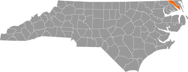
Camden County was formed from the northeastern part of Pasquotank County in 1777. It is named for Sir Charles Pratt, First Earl of Camden (1714–1794). He supported the US Revolution and opposed the Stamp Act. Pratt did not fight in the Revolutionary War but spoke out against the taxation of the American colonists in Parliament. The Great Dismal Swamp National Wildlife Refuge covers part of Camden County.
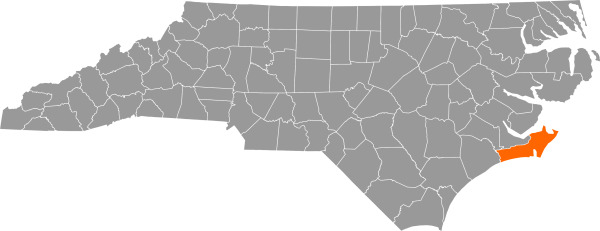
Carteret County is named for one of the Lord Proprietors of North Carolina. Some sources say it was named after George, Second Baronet (1667–1695); others say it was named after his son, John, Lord Carteret (1690–1763). It was formed in 1722 from a portion of Craven County. The original inhabitants of Carteret County were Iroquois-speaking Tuscarora. Settlers of German, Scots-Irish, English, and French descent settled in the area. Quaker families also began migrating south from Rhode Island in the 1720s. The county is home to Fort Macon. Its 1862 fall left much of eastern North Carolina under Union control during the Civil War.
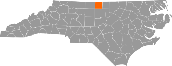
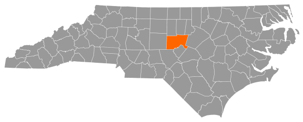
Caswell County was created in 1777 out of a portion of Orange County. It is named for Richard Caswell (1729–1789), the first governor of the independent state of North Carolina. He also fought in the Battle of Alamance during the Regulator Movement and was a member of the Continental Congress. The land is the ancestral home of the Occaneechi tribe and Siouan-speaking peoples. The Occaneechi Band of the Saponi and the Waccamaw Siouan Tribe are formally recognized by the state of North Carolina. German and English settlers later populated the region, and it became a hub for agriculture in North Carolina.
Catawba County was formed in 1842 from Lincoln County. It is named for the Catawba American Indian tribe, who once inhabited the area. First contact with the Catawba people was in 1540, when Spanish explorer Hernando de Soto and his soldiers marched through the Piedmont region. German Lutheran farmers settled the area in the 1700s. Today, the Catawba people primarily reside in South Carolina.
Chatham County was formed in 1771 and, like Caswell County, was made from a portion of Orange County. It was named for William Pitt, First Earl of Chatham (1708–1778). Pitt defended American rights in British Parliament before the American Revolution. He was against the harsh taxes and policies imposed on the American colony. Pittsboro, the county seat, is named for Pitt’s son, William the Younger (1759–1806).
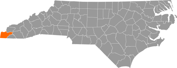
Cherokee County, formed in 1839 out of Macon County, is North Carolina’s westernmost county. It was named to honor the people of the Cherokee tribe, who were forcefully removed and relocated to Oklahoma on the Trail of Tears in 1838. The Eastern Band of Cherokee Indians—one of the eight state-recognized tribes— live on the Qualla Boundary. According to the county of Cherokee website, they are the descendants of the Cherokee who escaped removal during the Trail of Tears, survivors who walked home from Oklahoma, and those who hid in the mountains and refused to be relocated. The Qualla Boundary spans five counties, including Cherokee County.
Come back for part three of our Naming North Carolina series to see which counties are named for a river, a US Senator, and a prince!
Sources:
Eastern Band of Cherokee Indians